If you like the all-free articles on this blog, let Mary Anne know by gifting her with her all-time-favorite gift, an Amazon gift certificate. Her email is maf@lifeunfolds.com Amazon.com Gift Certificates - Click Here!

Thursday, December 28, 2006

Trail Bike Trails at Memorial Park


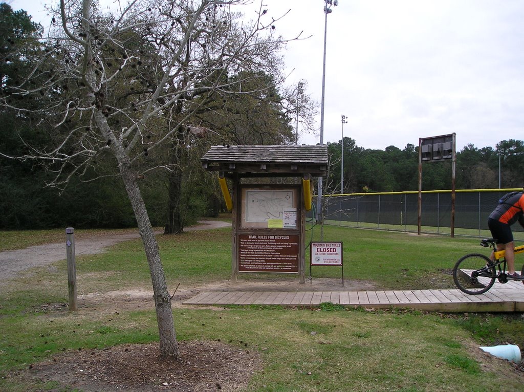
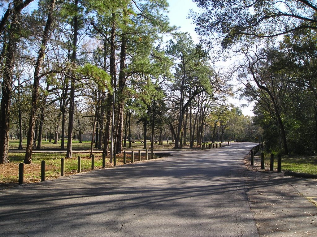
Upper Left: Trail Entrance Upper Right: Trail marker Bottom: Typical Trail
Introduction: Within Memorial Park are a set of trails collectively called the "Ho Chi Minh" trail. In fact, only one part of the trail is named Ho Chi Minh, but somehow the name was popularized to include the whole set. These may be the best trails inside the loop in Houston. The bike trails in Memorial Park are made for trail bikes, but are used by other cyclists, walkers, joggers and even horses. Unlike most Houston trails, they undulate, go up and down, cross creeks and run-offs, and are visually interesting. The trails twist and wind so you don't see what's ahead.

Location: The bike trails are directly across Memorial from the 3 mile track and right next to the baseball fields. If you're going west on Memorial, take a left on Picnic Loop. Barely to the right is one of the entrances to the trails. It is marked by a sign posting rules and a map. There actually are several entrances depending on which part of trail you want to walk on. See map for more details. Map is found at http://texashiker.com/Memorial_Park_Map.gif
Additional maps of Memorial Park are at http://www.memorialparkconservancy.org/index.cfm/CFID/33891231/CFTOKEN
/29642544/MenuItemID/116.htm


http://www.ghorba.org/trail-info/memorial_park The trail colors do not mean anything on this map, they just indicate a trail.

Additionally, there are trails including the West Memorial extension through the woods sometimes called "the triangle" also known as the Infantry Woods. To get to it, enter off the sidewalk near the Arboretum entrance, then go through the tunnel under Woodway. Meander east and, after 2 more tunnels, exit at the train tracks. Turn around, walk trail back to starting point.


Hours: Memorial Park is open from 6 am to 11 pm.

Scoring: Walking = 4 Nature = 5
Walking: Since the paths are shared with cyclists and visibility is limited due to curves, one must stay alert. The paths can be quite muddy after a hard rain. There are no restroom facilities or water on the paths. No lights either. There also are trail markers that indicate ease of trail, but not names of trails, so you can get lost. The great thing is the undulating paths, and the changes in grade and altitude. It makes walking a lot more interesting.

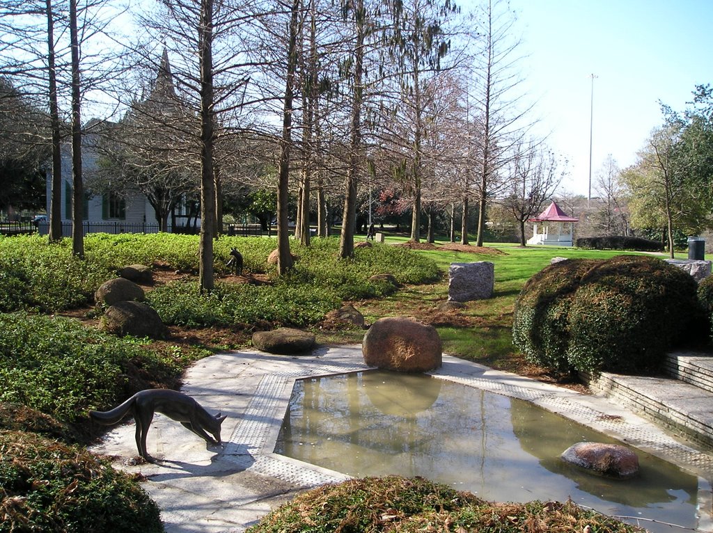
Nature: Surrounded by large trees, walking across and by creeks, Buffalo Bayou, and changes in the ground level by as much as 40 feet or so, it is a great walk for an inner city location. It is beautiful. Only drawback was noise from Memorial, although not nearly as pronounced as on the three mile track across the road. The farther you go back on the trails, the less the noise. Truthfully, I didn't find the noise distracting.

Background:

Coolest Thing About Park: Hard to believe these woods are so close to downtown. Friendly people on the trails.

Trails: I haven't walked all of it yet, but what I have walked is enticing. Trails are packed dirt, an occasional wooden walkway over low spots, sometimes level and sometimes up and down across gullies. There are lots of trip hazards, tree roots, potholes caused by bikes and repeated walking. The trails are shared by cyclists, walkers, joggers and horses (although I've never seen any horses). The trails are from narrow, maybe two feet across to road-sized. Some of the trails are along power easements and fire roads. At this writing (January 2007) several of the trails have been closed by he City of Houston. This and the fact that new trails are added or changed by bikers, the maps are just slightly helpful.

If you enter by the rugby pitch, you can walk about 1.5 miles in on wide level path before you have to turn around and come back. If you stay on the wide path , it's easy to see where you are. This trail is mostly flat and wide.

If you enter by the ball fields, there is a wide walkway (marked lavendar path) that goes about a mile in before veering off into a narrower path. The end of this mile is blocked although if you go around the sawhorses blocking the way, you will meet Buffalo Bayou shortly.
As you enter this trail, there is a blue marker turning left. If your turn here instead of following the lavendar trail above, you'll be on the blue trail. The blue trail is up and down and fairly narrow, but really nice. It connects with the lavendar trail to return you to the same place where you started. It's my favorite so far.


The trails use a marker system that indicates how difficult the path is for trail bikes. Red means easiest, blue means intermediate and black means difficult. But from my note above, I'm not sure these are valid on the map anymore.

Other things you'll want to know:

1. There are no lights.

2. The trail is mostly shaded.

3. No facilities (restrooms) or water on trail, although both are available within Memorial Park.

4. I only saw squirrels and birds, but there are snakes, turtles, raccoons, and other wildlife in the park.

5. Take water, cell phone and ID with you in case of mishap.

6. While you can feel lost, you can't get truly lost. The trails are bordered by Buffalo Bayou, baseball fields and a wide utility easement, the Arboretum and Memorial Drive. Eventually you'll hit one of them and know where you are. I just pay close attention to landmarks and usually find my way back easily.

Feel free to add any comments you think would be useful to others about this blog.

Photography by Mary Anne Fields.
All blog content is copyrighted, all rights reserved, Mary Anne Fields and Life Unfolds, 2006

Picnic Loop at Memorial Park


Introduction:The Picnic Loop of Memorial Park is on the south side of Memorial Drive. It is a paved road through part of the park which has many picnic tables along the side. This loop is popular with inline skaters, joggers, walkers, and cyclists. It is approximately 1.3 miles long (according to my car's speedometer) if you take the longest, outer loop.

Location:Going west on Memorial Drive, take a left on N. Picnic Lane. Immediately in the parking lot, you'll see the baseball fields to your right and if you turn left, it will take you to parking and the picnic loop road through the park. Maps to location are at http://www.memorialparkconservancy.org/index.cfm/CFID/33391157/CFTOKEN/65531864/MenuItemID/106/MenuGroup/Home.htm

Hours: Memorial Park is open from 6:00 a.m. - 11:00 p.m., 365 days/year. The picnic loop is shut off by gates at night.

Scoring: Walking = 4 Nature = 3.5
Walking: For some of the way you can walk on the grass along the road, but for some you must walk on the road. The road is fairly busy with cyclists and cars. The road is paved and level. However, when you get off in the grass, it can be muddy and uneven. Still a nice walk.

Nature: Again, even though it is in beautiful Memorial Park, it is beside the trees, not among them in a totally natural setting. Noisy since it is just off Memorial Drive, a very busy street.

Background:This is a popular place to picnic in the summer and to walk or jog year round. It is part of the Memorial Park system owned and managed by the City of Houston.

Coolest Thing About Park:

Trails:This is not a trail per se, but is used as one by many. You can't get lost if you follow the road. The road goes in a large double loop. The trail is a little more than a mile and easy to walk. Map of trail is at http://www.memorialparkconservancy.org/index.cfm?menuitemid=151

Other things you'll want to know:

1. Always take ID and water when walking.
2. The loop is busy so walkers and joggers must be alert to traffic, cyclists and skaters at all times.
3. This area is a little isolated from the main road (Memorial) and not that well lighted at night. Caution is warranted.

Feel free to add any comments you think would be useful to others about this blog.

Photography by Mary Anne Fields.
All blog content is copyrighted, all rights reserved, Mary Anne Fields and Life Unfolds, 2006

Saturday, December 23, 2006

Sam Houston Park - Downtown


Sorry I haven't posted in a while. I got sick right before Thanksgiving and have not fully recovered. I've not been out walking until today. We were looking for an easy walk close to home. Here's what we found. Today's walk is not my usual "nature" walk, but a really pretty walk nonetheless. Hope you'll try it out.

Introduction:Sam Houston Park, the home of many relocated historical Houston homes, was the first city park in Houston, created back in 1900. I couldn't find out how big it is, but I'm guessing between 10 and 15 acres.

Location:
The park is located on the corner of Bagby and Lamar Streets downtown. It is divided into three parts separated by city streets. The part with the trail is bounded by McKinney, I-45, Bagby and Allen Parkway. The park with Heritage Society museum is bounded by Allen Parkway, Bagby and I-45. The final part with the Kellum-Noble house and the museum parking area is bounded by Clay, Bagby, I-45 and Allen Parkway. The Heritage Society website encourages you to park in the museum parking lot and can be reached from Clay or Allen Parkway. We parked directly on Allen Parkway because it was Saturday. It is illegal to park there on weekdays.

Maps of the park can be found at:
http://www.heritagesociety.org/direct.html


Hours: Open 24 hours a day, 7 days a week.

Scoring: Walking = 3 Nature = 2.5
Walking: The sidewalked path is fairly short. To make it a decent length walk, you have to combine it with city streets, and possibly Tranquility Park. The walk has an incline in a loop around the bandstand (looks like a gazebo).

Nature: Even though it is downtown among tall buildings and freeways, the park is pretty with very large oaks and bald cypress. The pond is surrounded by cypress knees. There is a lot of noise due to the freeways adjacent to the park.

Background: This park was the first city park in Houston. In 1900, the then Mayor of Houston, Sam Brashier, bought the Kellem-Noble land and house on the edge of town. He created Sam Houston Park. In 1954, it also became the home of the Heritage Society. The Society has a small museum, and many old houses on the property. There is a pond and a bandstand, a small wooden bridge and a statue dedicated to the heroes of the Civil War. There is a fountain in the pond and also a really pretty Zen-like garden with benches, a fountain and two statues of coyotes around the pond.

Also located on The Heritage Society campus in Sam Houston Park, at the corner of Bagby and Lamar Streets, is a small museum, The Heritage Society Museum, dedicated to preserving Houston's history.

Coolest Thing About Park:It's downtown, but has a real outdoors feel. I loved the juxtaposition of the tall buildings to the huge oaks and green space. Plus, we were there on an absolutely gorgeous winter day and there were only two other people in the park. We had it all to ourselves. We saw ducks with tiny babies swimming in the pond.

Trails:Other things you'll want to know:

1. There is no lighting in the park. Would not recommend walking there after dark as it is lower than the surrounding area and thus hidden from public view.

2. We made it a longer walk by walking up Bagby, behind City Hall, one block to connect with Tranquility Park. Tranquility park is small also, but has really interesting fountains and walkways. It was created to commemorate the first moon landing on July 20th, 1969. Tranquility Park is at Walker and Risk east of Smith St. Officially it is at 400 Rusk St. We returned to Sam Houston Park by walking around the reflection pond in the front of City Hall.

3. The Heritage Society Museum is open to the public Tuesday – Saturday 10:00 a.m. –4:00 p.m. and Sundays 1:00 p.m. – 4:00 p.m. Admission to The Heritage Society Museum is free. This is where the bathrooms and water are.

4. Only wildlife we saw were squirrels and ducks and fish. The pond had a huge koi swimming along the bank.

5. The walkway around the bandstand in Sam Houston park has an incline, but it's very gradual. Might be difficult for wheelchairs.


Feel free to add any comments you think would be useful to others about this park.