If you like the all-free articles on this blog, let Mary Anne know by gifting her with her all-time-favorite gift, an Amazon gift certificate. Her email is maf@lifeunfolds.com Amazon.com Gift Certificates - Click Here!

Monday, November 09, 2009

Lone Star Hiking Trail

Did you know that Texas has it's very own "Appalachian" Trail? Okay, well, it's really not anything like the Appalachian Trail. No mountains, but hey, that can be a good thing. Especially in the hot, humid summers.

The Lone Star Trail is about 129 miles long and wanders through the Sam Houston National Forest. It's mostly flat with some wet areas. Bridges are in place for easy creek crossings. For more information:

http://www.fs.fed.us/r8/texas/recreation/sam_houston/lonestarhiking.shtml

http://lshtclub.com (Lone Star Hiking Trail Club)

Sunday, January 27, 2008

West 11th Street Park


"This beautiful 20.2 acre pocket wilderness is the largest remaining native Texas forest inside the 610 Loop. Containing amenities no money can buy - over 1000 mature trees, a growing and diverse understory, serene wooded trails, a diverse bird and butterfly fauna - this irreplaceable piece of parkland represents a haven for wildlife and a tranquil spot for Houstonians seeking respite from the stresses of urban living." This was quoted from the folks who worked so hard to save this small park. The accomplished their goal and we have a new city park.

I visited the park today and the trees are huge, almost stunningly so. Most are pines, but really tall. The park is not really big enough to call it a hiking park, but trails do criss-cross the entire acreage. It only took me 15 minutes to walk all the trails available, but it was still a nice walk.


There were several birders there talking about the many birds they'd sighted in the park. At the entrance, there is a bulletin board posting some of the birds in the park.


Trails are about 4 to 6 feet wide, with dirt and some grass, low in places so after our recent rains, quite muddy. However, I was able to walk the trails anyway without getting my feet wet. The park has no ameneties as of yet. That means no bathrooms, little signage, only one water fountain and one bench. The pocket park is surrounded by the Timbergrove neighborhood and felt safe. I walked the park at 4:30 on a Sunday and essentially had the trails to myself. Although I was told that the neighborhood citizens walk there often.

Bottom line is it's not a park for long distance walking, but a very nice short walk in a beautiful setting. It's worth going to just to gaze up at the trees.


It's located on West 11th Street just west of TC Jester. Look for the park bench as there is no obvious sign on 11th St.

Saturday, January 12, 2008

Links to More Trail Information

Found a couple of links this morning that I thought might help you get out and walk.

http://www.houstontx.gov/parks/parktrail-boundaries.html This link lists park trails in Houston parks and their length.

http://www.houstontx.gov/parks/bayou-trails.html This link lists the bayou and street trails and their address and length.

See you on the trails!

Saturday, May 05, 2007

Nature as Meditation


Nature inspires us, fills us with awe, and provides us with visual and auditory beauty. For me, nature is spiritual. It can change my sense of self, and alter my emotions and thoughts just by sitting or walking quietly in nature outdoors.


My own preferences include an ocean beach, forests, creeks, waterfalls and mountains, and the skies above. Each of these in its own way fills me up, spiritually. Others love the desert, lakes, or fields of grass. Some love gardens filled with flowers.


Nature can inspire even when raining or snowing or windy. Go out and experience it for yourself. I love to walk in the rain and even to watch thunderstorms. Every experience in nature can be a kind of meditation, even hiking or kayaking. Meditating in nature or on nature gives you another layer of insight, more depth in knowing about yourself and in healing yourself. Meditation can calm a noisy mind, will help you learn more about yourself, can answer the big questions in your life, will help you to be more grounded and centered, and to have equanimity and calm. Even five minutes a day will make a big difference. Fifteen to thirty is ideal. But don't let the lack of time stop you.


To meditate simply sit quietly outdoors. Sitting up straight will keep you from feeling sleepy. Observe what is around you, notice the beauty. Notice the sounds and sights and sensations, but don't create stories in your head about them. Don't like or dislike them. Simply notice and let them go. Gently close your eyes and breathe. Notice your breath as it comes and goes. If thoughts intrude, simply imagine that they are clouds in the sky and watch them go by. I end my meditations with gratitude. In this case, gratitude for nature and all it provides and for the time and energy to meditate.


I hope you will try it a few times. See what works best for you. Let me know what your experience is with meditating or send me questions.


All content including photos are copyrighted, 2006, by Mary Anne Fields and Life Unfolds. All rights reserved.

Monday, April 09, 2007

Save a Park


As many of you who love the outdoors know, city, state and federal parks are taking a beating from being chronically underfunded. Maintenance is not being kept up, some parks are being let go (sold or given away) and new park lands are not being added except when generous landowners donate the land. This is a crisis as far as I am concerned. The next link is a presentation from the Texas Sierra Club on the state of parks in Texas.
http://texas.sierraclub.org/events/legwork06/trapslonestarsierraclubpresentationonlocalparkissues.pdf

From this report: "Texas has a statewide average of 12.2 acres per 1,000 people in local parks, ranking it substantially below the national goal of 22-30 acres per 1,000 people as recommended by the National Recreation and Park Association"

And a link with a parks score that shows Houston is behind in parks and recreation opportunities at http://www.earthday.net/UER/report/tx_houston.html The details of the report says that while Houston is the fourth largest city, it is ranked at 37th in number of parks and 28th in park area per citizen.

Which brings me to the Save a Park idea. If you check this link: http://savethispark.org, you'll find some folks who have put together a coalition to buy park land that is under threat. From their website: "This beautiful 20.2 acre pocket wilderness is the largest remaining native Texas forest inside the 610 Loop. Containing amenities no money can buy - over 1000 mature trees, a growing and diverse understory, serene wooded trails, a diverse bird and butterfly fauna - this irreplaceable piece of parkland represents a haven for wildlife and a tranquil spot for Houstonians seeking respite from the stresses of urban living.

To lose even a portion of the 20.2 acres would seriously compromise the integrity and tranquility of the remainder. Yet 5 acres is still under threat of being turned from nature preserve into townhomes. In order to fulfill the purchase option with HISD, that much of the park was put up as collateral for a bridge loan that enabled the Houston Parks Board to fulfill the purchase price by the contract’s deadline."

If you feel you can donate, use the above website to do so.

But here's an even better idea (not mine but I borrow from wherever I can!). First ask your company (where you work) to donate to this cause. Many companies have matching programs, ask HR department.

If you work for a company or own a company here in Houston or in the Houston area, why not persuade your company to buy land for a park near its location and donate it to the city or county. It's odd to me that a company will use millions to buy the rights to name a stadium, but will not donate millions to add parks to the place where they are located and where their thousands of employees live. If you work for a smaller company, ask them to donate upgrades to an existing park. I can picture Exxon benches and water fountains, Lockheed playgrounds, and Chase/JP Morgan walkways and exercise equipment. How about an American National Insurance fountain and an AIG sculpture in an existing park? An Anadarko Petroleum climbing wall and a Baker Hughes picnic pavilion? For smaller companies, maybe a few trees planted with a plaque or a bench painted with their logo. They can advertize to their heart's content so long as it benefits the city and its citizens. This idea is already used in museums, such as the Children's Museum of Houston where corporations have their names plastered all over the building and exhibits, which they paid for or underwrote.

Many foundations and non-profits donate to park organizations such as the Buffalo Bayou partnership. Through corporate and foundation support, parks are being added, but slowly. Here's an example of what can be done: http://www.buffalobayou.org/sabinebagby.html

I can imagine a time when our city is twice the size in population and half the size in park land. Is that a city where you'd want to live? Act now and save our parks!

Friday, March 16, 2007

Terry Hershey Park (Hike and Bike Trail)


Introduction: Terry Hershey Park is part of the Harris County park system. It has a small playground, a gazebo, and approximately 10.83 miles of hike and bike trails. It stretches from the Barker Dam, east along Buffalo Bayou to beltway 8 near the junction of Rummel Creek and Buffalo Bayou. http://www.pct3.hctx.net/parks/terryhershey.aspx

NOTE 09/08: TERRY HERSHEY PARK - WEST HOUSTON BIKEWAY CONSTRUCTION PROJECT; this City of Houston and Texas Department of Transportation (TxDOT) construction project will impact Terry Hershey Trail operations between Eldridge Parkway to the parking lot on I-10. In fact, the portion of the trail under construction may be completely closed for an extended period of time. Please contact TxDOT at 713-934-5900 if you have any questions about the construction of this project. You may also wish to look at the City's website for more information on the project at City of Houston's West Houston Bikeway Program.

Location:The official address is 15200 Memorial Drive at Memorial Mews. This is between Eldridge Parkway and Highway 6. This main parking lot is where the playground, orchard and gazebo are located. It also has a good map of the entire park. Parking lots are provided at Highway 6, north of the bayou, and Beltway 8 (access off southbound tollway service road). Also, there are parking lots on Dairy Ashford on the south side of the bayou, and on the north and south sides of Memorial Drive at South Mayde Creek, and off the east bound I-10 service road at South Mayde Creek. http://maps.live.com/default.aspx?wip=2&v=2&style=r&rtp=~&&cp=29.77989~-95.62299&lvl=14&sp=aN.29.77989_-95.62299_15200%20Memorial%20Dr,%20Houston,%20TX%2077079&msnurl=map.aspx?L%3dUSA%26C%3d29.77989%2c-95.62299%26A%3d7.16667%26P%3d%7c29.77989%2c-95.62299%7c1%7c15200+Memorial+Dr%2c+Houston%2c+TX+77079%7cL1%7c%26redirect%3dfalse&msnculture=en-US

Hours: 7 am to 10 pm

Scoring: Walking = 4.5 Nature = 4
Walking: The walkway is concrete and asphault, well maintained, even and about 10 feet wide. Noise level is moderate as it is a little distance from Memorial Drive. Some of the trail is lighted and there are restroom facilities and water fountains available. The trail is shared with cyclists, most were going too fast and did not let walkers know they were passing. Parts were under tall trees, but a lot of it was not shaded. There were no trail markers to let you know which trail you were on and how long you'd be walking. However, there is a good map at the trailhead. There are also occasional park benches along the trail.

Nature: The entire trail system runs along Buffalo Bayou. On one side of the trail is the bayou, the other side was residential neighborhoods, but these were mostly shielded by large berms. These berms also offer the walker a chance to climb up and down to get better exercise. Lots of birds; I even saw a couple of hawks. Mockingbird Trail is mostly in the sun, not shaded.

Background:The land for this park was originally acquired in the 1940s as part of the Addicks and Barker Reservoir projects. Harris County began planing the park in 1985 and leased 500 acres aong the banks of Buffalo Bayou and South Mayde Creek from the Flood Control District in 1987. Harris County Commissioner Radack proposed changing the name from Buffalo Bayou Park to Terry Hershey Park to honor the conservationist who led the campaign in the 1960s to derail a plan to pave the banks of Buffalo Bayou as had been done earlier to portions of the banks of White Oak Bayou and Bray's Bayou.

Along the trail, there are ten bridges. Lots of tall trees and interesting bushes along the trail and the bayou. Saw blackberry bushes, azaleas, purple mountain laurel. Small patches of wildflowers were blooming on the berms and along the trail (in March 2007).

The Hike and Bike Trail is the main element in Terry Hershey Park. But there are other features, including restrooms, gazebos, a lighted walking trail, exercise stations, playground, and picnic sites. There is a walk-in sundial where your shadow will tell you the time if you stand on the appropriate stone (and if the sun is shining). This feature is in the section of the park between Memorial Drive and Interstate 10.

Coolest Thing About Park: This is one section of the bayou walks in the city that "felt" safe. There were no vagrants or homeless about, probably because this is so far out of the downtown area. I really enjoyed being able to walk alone along the bayou, something I feel uncomfortable doing nearer my home in the Montrose area. I walked around Noon on a Friday, and there were just enough folks about that I didn't worry, but not too many to feel crowded.

Trails: Trails are well maintained, about 10 feet wide and built of concrete or asphault with rocks embedded. The ones nearest the main park facility are well-lighted.

The trails are Cardinal Trail loop (.9 miles), Blue Jay trail loop (1.25 miles), Mockingbird trail (hwy 6 to Eldridge - 1.62 miles), Quail Trail (Eldrige to Dairy Ashford - 1.5 miles) (Dairy Ashford to Kirkwood - 1.1 miles) (Kirkwood to Wilcrest - 1.09 miles) (Wilcrest to Beltway 98 - 1.31 miles), Robin Trail (.45 miles), and Robin Loop (1.61 miles). The Cardinal and Blue Jay trails are around the main park site near the playground and the orchard. Trails are not marked (as far as I could tell), but there is a map near the playground. Map can also be found at http://www.pct3.hctx.net/pterry/Layout.pdf

Other things you'll want to know:

1. Bathroom facilities are at the main park at 15200 Memorial. Also on Quail Trail east of Eldridge.
2. There are water fountains, including doggie water fountains all along the trail. Also a runner's shower (outdoors) on the quail trail.
3. All of Cardinal and Blue Jay trails are lighted.
4. Much of the trail would be appropriate for wheelchairs, although I thought the walkway that went under Memorial was too steep.
5. People walking the trail included women pushing strollers, cyclists, fathers and their children, solo men and solo women of all ages.
6. Saw birds, squirrels and some interesting plants (wish I knew what they were!).
7. Park has picnic tables, playground, Molly Pryor Orchard, walk-in sundial, and a gazebo.
8. As always, carry ID, cell phone and water with you and use sunscreen as much of the trails are not shaded.
9. Harris County constables patrol the trails and the park.
10. No alcoholic beverages are allowed in park and pets must be on leash.

Feel free to add any comments you think would be useful to others about this blog.

Photography by Mary Anne Fields.
All blog content is copyrighted, all rights reserved, Mary Anne Fields and Life Unfolds, 2006

Monday, February 19, 2007

E.R. and Ann Taylor Park


Introduction: ER and Ann Taylor Park is a 26 acre park located at 1850 Reed Road, just south of Reliant Center. It is known by birders for its many species of birds migrating through the park. It has several bird blinds including raised ones. The park also has several of the largest oak trees I've ever seen. They are settled in the midst of forest trees and bogs.

Location:Located at 1850 Reed Road, near the intersection of Reed and Almeda. From downtown, take 288 south, exit Reed Road, turn west (right). It is located next door to a rodeo parking lot and backs up against Almeda. Maps to location: Click Here

There is a good trail map posted at the park. Here is an online copy but very difficult to read: http://www.houstontx.gov/parks/images/Parks/wpe9.gif

Hours:Could not find the hours posted, but there is a gate at the entrance. Since the park is unattended and there are no lights on the paths, I assume it is only open during the day.

Scoring: Walking = 3.5 Nature = 4
Walking: There is an uneven concrete path with some stretches of wooden boardwalks throughout the park. Good signage with mileage indicated for each part. Maybe because it is winter, parts of the path were obstructed with downed trees and overgrown bushes or weeds. I could get around them easily by going off the path. No bathrooms, water or lights. Most of walk was shady.

Nature: Lots of birds. There are bird blinds and bat boxes throughout. Several huge oaks. There is a large pond and several bogs (which may be seasonal). While I didn't see any, there are rabbits, raccoons, armadillos and foxes in the park. The back side borders busy Almeda Road which made it quite noisy.

Background: This park land was donated to the City of Houston by descendants of ER and Ann Taylor. Edward Ruthven Taylor was ill with tuberculosis after the Civil War. He was nursed back to health by his father's former slave, Ann George. They fell in love, but were unable to marry due to social and legal norms at the time. The two moved to this property which was named Myrtle after the fragrant myrtle trees on the property. They raised six children who were among the first African-Americans to graduate from college in Texas. Oil was discovered on the land and in 1921 oil was being produced from wells there.

Coolest Thing About Park:The history of the park which includes a cemetery within.

Trails:The trail is 1.08 miles long and winds through forest and bogs and beside a pond. The trails are well defined and about 4 feet wide made of concrete and sometimes boardwalks over the more boggy areas. There is excellent signage with milage indicated. There also is a two story viewing stand near the pond. Bird blinds are throughout the park. At this writing, the trails were somewhat overgrown in places. Without this, it would make a great park for small children to walk as the trails are well defined and not too long.

Other things you'll want to know:

1. No water, bathroom facilities or lights in the park.
2. It is somewhat isolated. I was there on a Monday morning and was the only person in the park. Be sure to carry cell phone and water and ID whenever walking. My guess is weekends and summer would be more populated.
3. Nice picnic pavilion at the entrance with roof, several picnic tables.
4. Take binoculars for the bird watching.


Feel free to add any comments you think would be useful to others about this blog.

Photography by Mary Anne Fields.
All blog content is copyrighted, all rights reserved, Mary Anne Fields and Life Unfolds, 2006

Thursday, February 08, 2007

Galveston Beach in Winter


I spent the weekend in Galveston at a beach house attending a spiritual retreat. I was pleasantly surprised at how empty the beaches were and how beautiful the weather was for walking. There were literally miles of empty beach, tons of seashells, nice breezes, perfect for walking. We entered the beach at 11 mile road out on the west end at Jamaica Beach. You can't park on the beach itself, but can park along the entrance road. Police patrolled the beach several times while we were there, so don't take a chance on having your car towed!

The beach was essentially empty. We only saw a few people walking the entire weekend. The sand was hardpacked because of the recent rain, perfect for walking. Lots of sea birds, nice waves, enough clouds to keep from being burned. Just lovely. You really could walk for several miles without obstacles.

Tuesday, January 30, 2007

Nature Links and Resources

Here are a few links and resources to help you in your nature and hiking activities.

http://www.fun365days.com/hiking.php (hiking trails on Texas Gulf Coast)

http://www.lshtclub.com/Hikebackpackcamp.htm (Lone Star Hiking Trail Club)

http://www.harra.org/ (Houston Area Runners organization)

http://www.texasoutside.com/hikebike/houstonhikingtrails.htm (Houston hiking trails)

http://www.texasoutside.com/houston/outdoorclubs.htm (REI's Houston activities listings)

http://www.westurealestate.com/outdoors.htm (listing of Houston outdoor groups)

http://www.buffalobayou.org/parks.html (Buffalo Bayou organization website)

http://texas.sierraclub.org/houston/ (Sierra Club Houston)

http://www.texasoutside.com/hiking.htm (Texas hiking and biking groups listing)

http://www.texastrails.org/ (Texas Trails Network website)

http://walktexas.org/ (Texas Volkssport network)

http://www.houstonwilderness.org/default.asp?Mode=DirectoryDisplay&id=52# (Houston wilderness group)

http://lifesbetteroutside.tpwd.state.tx.us/ (Texas Parks and Wildlife)

http://houstonhappyhikers.org/

My personal favorite, http://texashiker.com seems to be gone from the Internet. But check back, it may reappear!

Tuesday, January 23, 2007

Nature's Revelry

I have been participating in an art journal project for the past year with Kay Kemp's Wild Heart Art group. There are 14 artists each with a journal and a theme. We each do a couple of pages in the other's journals around their theme. It has been an incredible experience. My theme was Nature's Revelry. Here's a poem I wrote for the journal project. Even though it's the first poem I've ever written, I am quite happy with it.

Nature’s Revelry

i am not separate from
a butterfly’s wings
shimmering, iridescent,
blue-hued beauty
gliding on the summer air

i am not separate from
the autumn leaves falling
glorious red and radiant gold
floating and flying then
flickering in the still, shallow pond

i am not separate from
the seashell’s whorls
patterned round and round
turning somersaults in the turquoise waves
settling in soft, wet sand

i am not separate from
the creek tumbling o’er the rocks
rushing, glimmering, splashing, playing,
speaking with musical laughter
as it flows ever onward home

i am not separate from
the ivory mistress moon
luminous, rising over the field
hovering, pocked with mystery
giving benedictions in shadows and light

i am not separate from
the masterful, majestic sun
reflecting diamonds and sapphires
off the life-giving oceans
dazzling the eyes, uplifting the soul

i am not separate from
nature’s revelry
the celebration of beauty and being
our frolicking, gaudy display
reminding us to be alive with joy.

All photos and text, Copyright © 2006 Mary Anne Fields, all rights reserved.

Saturday, January 20, 2007

Tree Facts

I love trees. I love looking at them, planting and growing them, walking through them. I was discussing some of the incredible stories about trees from the book, A Walk in the Woods: Rediscovering America on the Appalachian Trail by Bill Bryson with some friends last week. In that conversation, someone said they knew of trees more than 1000 feet tall. That seemed unbelievable to me so I did some research. Did you know?:

The tallest trees in the world (from Wikipedia):
Coast Redwood Sequoia sempervirens: 115.55 m (379.1 ft.), Redwood National Park, California

Coast Douglas-fir Pseudotsuga menziesii: 100.3 m (329.1 ft.), Brummit Creek, Coos County, Oregon

Australian Mountain-ash Eucalyptus regnans: 97.0 m (318.2 ft.), Styx Valley, Tasmania

Sitka Spruce Picea sitchensis: 96.7 m (317.3 ft.), Prairie Creek Redwoods State Park, California

Giant Sequoia Sequoiadendron giganteum: 94.9 m (307.1 ft.), Redwood Mountain Grove, Kings Canyon National Park, California

There used to be taller trees (some documented at 500 feet), but many have been lost to fire, natural disasters and man.

The largest girth in diameter, excluding baobabs (because they hold water and vary widely over time), are:

Montezuma Cypress Taxodium mucronatum: 11.42 m, Árbol del Tule, Santa Maria del Tule, Oaxaca, Mexico

Giant Sequoia Sequoiadendron giganteum: 8.85 m, General Grant tree, Grant Grove, California

Coast Redwood Sequoia sempervirens: 7.44 m, Prairie Creek Redwoods State Park, California

And the largest in overall volume are:

Giant Sequoia Sequoiadendron giganteum: 1489 m³, General Sherman
Coast Redwood Sequoia sempervirens: 1045 m³, Del Norte Titan tree

Western Redcedar Thuja plicata: 500 m³, Quinault Lake Redcedar

Kauri Agathis australis: 400 m³, Tane Mahuta tree (total volume, including branches, 516.7 m³)

Oldest trees are (and this blew my mind!!) are:

Great Basin Bristlecone Pine Pinus longaeva: 4844 years
Alerce Fitzroya cupressoides: 3622 years
Giant Sequoia Sequoiadendron giganteum: 3266 years
Huon-pine Lagarostrobos franklinii: 2500 years
Rocky Mountains Bristlecone Pine Pinus aristata: 2435 years

Here is a link to the largest trees in the Houston area: http://www.parkpeople.org/parkpeople/Tree_Registry.asp?SnID=2

Wednesday, January 03, 2007

Rice University Loop


Introduction: The Rice University near the medical center in Houston has a three mile loop around its campus which is popular with both joggers and walkers. Most of the loop is lined by large oak trees which offer shade in the summer. This loop is also right across the street from Hermann Park which has a one mile and a two mile loop which can be connected for a total of six miles. The metro train stops at Hermann Park as well making it an easy place to get to.

Location: Rice University is located at 6100 Main St. between Sunset and University. The walking loop is completely around the campus, on Main, Sunset, Rice, Greenbriar and University streets. Parking is on Rice at entrances 17, 18 and 20 in visitor parking. Maps can be found at http://futureowls.rice.edu/futureowls/Driving_Directions.asp and http://www.rice.edu/maps/maps.html. Or take the metro train which stops directly across from the loop.

Hours:24 hours a day, 365 days a year.

Scoring: Walking = 3.5 Nature = 3
Walking: The path is fairly even and wide and consists of crushed granite and concrete walkways. It can be a little muddy after a heavy rain. There are street lights all along the loop, but they light the streets, and only partially light the walkways. There are two significant drawbacks to the loop: (1) noise because all parts are on busy city streets, and (2) some of the walk crosses busy parking lot driveways where you may have to stop and certainly have to be alert.

Nature: The trees are quite nice, large and provide shade. Some parts of the loop are landscaped nicely. It still is, though, in a busy area of the city.

Background:

Coolest Thing About Park: It can be connected to the trails at Hermann Park, it's near a metro station and you can also walk through the campus which is very pretty.

Trails: There is no way to get lost, just follow the sidewalk all the way around the campus. Occasionally, you have to turn, but it's pretty obvious where to go. If you're walking in front of residences, you went the wrong way. Pay attention to traffic. Bicycles, runner and walkers all share the path. Trail is flat and wide and easy to walk on.

Other things you'll want to know:

1. No water or restroom facilities are on the trail. Although if you're desperate you can always walk on campus and find one. (NOTE: I received a comment that there are two water fountains on the trail. I'll update again after I find them and note their locations. Keep your eyes open if you're walking the loop.)
2. Even though some people do walk there at night, I would not. It's not quite well enough lighted and is relatively close to some not so nice areas of town.
3. Take water, cell phone and ID whenever you walk anywhere.

Feel free to add any comments you think would be useful to others about this blog.

Photography by Mary Anne Fields.
All blog content is copyrighted, all rights reserved, Mary Anne Fields and Life Unfolds, 2006

Thursday, December 28, 2006

Trail Bike Trails at Memorial Park


Upper Left: Trail Entrance Upper Right: Trail marker Bottom: Typical Trail
Introduction: Within Memorial Park are a set of trails collectively called the "Ho Chi Minh" trail. In fact, only one part of the trail is named Ho Chi Minh, but somehow the name was popularized to include the whole set. These may be the best trails inside the loop in Houston. The bike trails in Memorial Park are made for trail bikes, but are used by other cyclists, walkers, joggers and even horses. Unlike most Houston trails, they undulate, go up and down, cross creeks and run-offs, and are visually interesting. The trails twist and wind so you don't see what's ahead.

Location: The bike trails are directly across Memorial from the 3 mile track and right next to the baseball fields. If you're going west on Memorial, take a left on Picnic Loop. Barely to the right is one of the entrances to the trails. It is marked by a sign posting rules and a map. There actually are several entrances depending on which part of trail you want to walk on. See map for more details. Map is found at http://texashiker.com/Memorial_Park_Map.gif
Additional maps of Memorial Park are at http://www.memorialparkconservancy.org/index.cfm/CFID/33891231/CFTOKEN
/29642544/MenuItemID/116.htm


http://www.ghorba.org/trail-info/memorial_park The trail colors do not mean anything on this map, they just indicate a trail.

Additionally, there are trails including the West Memorial extension through the woods sometimes called "the triangle" also known as the Infantry Woods. To get to it, enter off the sidewalk near the Arboretum entrance, then go through the tunnel under Woodway. Meander east and, after 2 more tunnels, exit at the train tracks. Turn around, walk trail back to starting point.


Hours: Memorial Park is open from 6 am to 11 pm.

Scoring: Walking = 4 Nature = 5
Walking: Since the paths are shared with cyclists and visibility is limited due to curves, one must stay alert. The paths can be quite muddy after a hard rain. There are no restroom facilities or water on the paths. No lights either. There also are trail markers that indicate ease of trail, but not names of trails, so you can get lost. The great thing is the undulating paths, and the changes in grade and altitude. It makes walking a lot more interesting.

Nature: Surrounded by large trees, walking across and by creeks, Buffalo Bayou, and changes in the ground level by as much as 40 feet or so, it is a great walk for an inner city location. It is beautiful. Only drawback was noise from Memorial, although not nearly as pronounced as on the three mile track across the road. The farther you go back on the trails, the less the noise. Truthfully, I didn't find the noise distracting.

Background:

Coolest Thing About Park: Hard to believe these woods are so close to downtown. Friendly people on the trails.

Trails: I haven't walked all of it yet, but what I have walked is enticing. Trails are packed dirt, an occasional wooden walkway over low spots, sometimes level and sometimes up and down across gullies. There are lots of trip hazards, tree roots, potholes caused by bikes and repeated walking. The trails are shared by cyclists, walkers, joggers and horses (although I've never seen any horses). The trails are from narrow, maybe two feet across to road-sized. Some of the trails are along power easements and fire roads. At this writing (January 2007) several of the trails have been closed by he City of Houston. This and the fact that new trails are added or changed by bikers, the maps are just slightly helpful.

If you enter by the rugby pitch, you can walk about 1.5 miles in on wide level path before you have to turn around and come back. If you stay on the wide path , it's easy to see where you are. This trail is mostly flat and wide.

If you enter by the ball fields, there is a wide walkway (marked lavendar path) that goes about a mile in before veering off into a narrower path. The end of this mile is blocked although if you go around the sawhorses blocking the way, you will meet Buffalo Bayou shortly.
As you enter this trail, there is a blue marker turning left. If your turn here instead of following the lavendar trail above, you'll be on the blue trail. The blue trail is up and down and fairly narrow, but really nice. It connects with the lavendar trail to return you to the same place where you started. It's my favorite so far.


The trails use a marker system that indicates how difficult the path is for trail bikes. Red means easiest, blue means intermediate and black means difficult. But from my note above, I'm not sure these are valid on the map anymore.

Other things you'll want to know:

1. There are no lights.

2. The trail is mostly shaded.

3. No facilities (restrooms) or water on trail, although both are available within Memorial Park.

4. I only saw squirrels and birds, but there are snakes, turtles, raccoons, and other wildlife in the park.

5. Take water, cell phone and ID with you in case of mishap.

6. While you can feel lost, you can't get truly lost. The trails are bordered by Buffalo Bayou, baseball fields and a wide utility easement, the Arboretum and Memorial Drive. Eventually you'll hit one of them and know where you are. I just pay close attention to landmarks and usually find my way back easily.

Feel free to add any comments you think would be useful to others about this blog.

Photography by Mary Anne Fields.
All blog content is copyrighted, all rights reserved, Mary Anne Fields and Life Unfolds, 2006

Picnic Loop at Memorial Park


Introduction:The Picnic Loop of Memorial Park is on the south side of Memorial Drive. It is a paved road through part of the park which has many picnic tables along the side. This loop is popular with inline skaters, joggers, walkers, and cyclists. It is approximately 1.3 miles long (according to my car's speedometer) if you take the longest, outer loop.

Location:Going west on Memorial Drive, take a left on N. Picnic Lane. Immediately in the parking lot, you'll see the baseball fields to your right and if you turn left, it will take you to parking and the picnic loop road through the park. Maps to location are at http://www.memorialparkconservancy.org/index.cfm/CFID/33391157/CFTOKEN/65531864/MenuItemID/106/MenuGroup/Home.htm

Hours: Memorial Park is open from 6:00 a.m. - 11:00 p.m., 365 days/year. The picnic loop is shut off by gates at night.

Scoring: Walking = 4 Nature = 3.5
Walking: For some of the way you can walk on the grass along the road, but for some you must walk on the road. The road is fairly busy with cyclists and cars. The road is paved and level. However, when you get off in the grass, it can be muddy and uneven. Still a nice walk.

Nature: Again, even though it is in beautiful Memorial Park, it is beside the trees, not among them in a totally natural setting. Noisy since it is just off Memorial Drive, a very busy street.

Background:This is a popular place to picnic in the summer and to walk or jog year round. It is part of the Memorial Park system owned and managed by the City of Houston.

Coolest Thing About Park:

Trails:This is not a trail per se, but is used as one by many. You can't get lost if you follow the road. The road goes in a large double loop. The trail is a little more than a mile and easy to walk. Map of trail is at http://www.memorialparkconservancy.org/index.cfm?menuitemid=151

Other things you'll want to know:

1. Always take ID and water when walking.
2. The loop is busy so walkers and joggers must be alert to traffic, cyclists and skaters at all times.
3. This area is a little isolated from the main road (Memorial) and not that well lighted at night. Caution is warranted.

Feel free to add any comments you think would be useful to others about this blog.

Photography by Mary Anne Fields.
All blog content is copyrighted, all rights reserved, Mary Anne Fields and Life Unfolds, 2006

Saturday, December 23, 2006

Sam Houston Park - Downtown


Sorry I haven't posted in a while. I got sick right before Thanksgiving and have not fully recovered. I've not been out walking until today. We were looking for an easy walk close to home. Here's what we found. Today's walk is not my usual "nature" walk, but a really pretty walk nonetheless. Hope you'll try it out.

Introduction:Sam Houston Park, the home of many relocated historical Houston homes, was the first city park in Houston, created back in 1900. I couldn't find out how big it is, but I'm guessing between 10 and 15 acres.

Location:
The park is located on the corner of Bagby and Lamar Streets downtown. It is divided into three parts separated by city streets. The part with the trail is bounded by McKinney, I-45, Bagby and Allen Parkway. The park with Heritage Society museum is bounded by Allen Parkway, Bagby and I-45. The final part with the Kellum-Noble house and the museum parking area is bounded by Clay, Bagby, I-45 and Allen Parkway. The Heritage Society website encourages you to park in the museum parking lot and can be reached from Clay or Allen Parkway. We parked directly on Allen Parkway because it was Saturday. It is illegal to park there on weekdays.

Maps of the park can be found at:
http://www.heritagesociety.org/direct.html


Hours: Open 24 hours a day, 7 days a week.

Scoring: Walking = 3 Nature = 2.5
Walking: The sidewalked path is fairly short. To make it a decent length walk, you have to combine it with city streets, and possibly Tranquility Park. The walk has an incline in a loop around the bandstand (looks like a gazebo).

Nature: Even though it is downtown among tall buildings and freeways, the park is pretty with very large oaks and bald cypress. The pond is surrounded by cypress knees. There is a lot of noise due to the freeways adjacent to the park.

Background: This park was the first city park in Houston. In 1900, the then Mayor of Houston, Sam Brashier, bought the Kellem-Noble land and house on the edge of town. He created Sam Houston Park. In 1954, it also became the home of the Heritage Society. The Society has a small museum, and many old houses on the property. There is a pond and a bandstand, a small wooden bridge and a statue dedicated to the heroes of the Civil War. There is a fountain in the pond and also a really pretty Zen-like garden with benches, a fountain and two statues of coyotes around the pond.

Also located on The Heritage Society campus in Sam Houston Park, at the corner of Bagby and Lamar Streets, is a small museum, The Heritage Society Museum, dedicated to preserving Houston's history.

Coolest Thing About Park:It's downtown, but has a real outdoors feel. I loved the juxtaposition of the tall buildings to the huge oaks and green space. Plus, we were there on an absolutely gorgeous winter day and there were only two other people in the park. We had it all to ourselves. We saw ducks with tiny babies swimming in the pond.

Trails:Other things you'll want to know:

1. There is no lighting in the park. Would not recommend walking there after dark as it is lower than the surrounding area and thus hidden from public view.

2. We made it a longer walk by walking up Bagby, behind City Hall, one block to connect with Tranquility Park. Tranquility park is small also, but has really interesting fountains and walkways. It was created to commemorate the first moon landing on July 20th, 1969. Tranquility Park is at Walker and Risk east of Smith St. Officially it is at 400 Rusk St. We returned to Sam Houston Park by walking around the reflection pond in the front of City Hall.

3. The Heritage Society Museum is open to the public Tuesday – Saturday 10:00 a.m. –4:00 p.m. and Sundays 1:00 p.m. – 4:00 p.m. Admission to The Heritage Society Museum is free. This is where the bathrooms and water are.

4. Only wildlife we saw were squirrels and ducks and fish. The pond had a huge koi swimming along the bank.

5. The walkway around the bandstand in Sam Houston park has an incline, but it's very gradual. Might be difficult for wheelchairs.


Feel free to add any comments you think would be useful to others about this park.

Sunday, November 19, 2006

Memorial Park - Three Mile Circle


Introduction: The most popular walking and jogging trail in Memorial Park (and possibly in the city) is the three mile loop. Memorial Park is the largest urban park in Texas and covers approximately 1,466 acres. It is inside the 610 loop and not that far from downtown Houston.

Location:The park is located at 6501 Memorial Drive. From downtown, go west on Memorial Drive past Shepherd, past Westcott. Park is on both sides of Memorial Drive, north and south. The 3 mile loop is on the north side (right side going from downtown to Galleria). Turn right on the Memorial Loop road and park in designated spots or lots. I park near the tennis courts on the street. Maps are available at http://www.memorialparkconservancy.org/index.cfm?menuitemid=151

Hours:6 am to 11 pm (although I've seen joggers and walkers walking this path later than 11 pm!) Paths are lighted for night walks.

Scoring: Walking = 4.5 Nature = 3.5
Walking: Points lost for noise as most of walk is on busy Memorial Drive or streets. It also is a very busy walk with too many people on it for my comfort.

Nature: While it is in Memorial Park which is beautiful, the walk itself simply circles the woodlands, and does not go through it. You can see the trees, but you're not in them.

Background:Memorial Park used to be part of Camp Logan, a WWI training center outside the city limits of Houston. It was built in 1917. It was used for training and also for caring for wounded soldiers at times. The infamous Houston Riot of 1917 occurred there caused by trouble between the local police force and black soldiers stationed at the camp. Declaration of martial law ensued. After the war, the land was acquired by the Hogg family and sold to the City of Houston at cost. This later became Memorial Park.

Within the park are the Arboretum and Nature Center, a golf course, miles of hiking, biking and jogging trails, tennis courts, volleyball courts, roads for inline skating, softball fields, swimming and other sports. There are also picnic tables and benches for sitting along the roads and some trails. The Seymour Lieberman Exercise Trail is the same as the 3 mile loop so there are exercise "stations" along the path where you can stretch, do chin-ups, etc.

Coolest Thing About Walk: Great people watching!

Trails: This trail is crushed granite and wide enough for several to walk abreast. The trails are very busy all during the day, even on weekdays. It is well lighted for night walking. The trails are fairly even and have decent drainage. They can be muddy after heavy rains. There are bathrooms and water available on this trail. It is mostly shaded. The trail is in a loop around the golf course and runs along the road/loop through the north side of the park. Because of this, it is fairly noisy. Due to this heavy traffic, if you have respiratory illness or sensitivity to environmental conditions, you should take caution. You will see all types of walkers and runners - women pushing baby carriages, elders walking and jogging, fit 20 and 30 somethings, and dog-walkers.

Other things you'll want to know:

1. As with all walking, be sure to take your cell phone and identification as well as water in the hot summer months.
2. Park only in designated spots, they are plenty and easy to find.
3. Trail has good lighting for night walking and jogging.

Feel free to add any comments you think would be useful to others about this trail.

Photography by Mary Anne Fields.
All blog content is copyrighted, all rights reserved, Mary Anne Fields and Life Unfolds, 2006

Monday, October 30, 2006

Technorati Post

Technorati Profile

One Square Inch of Silence

Gordon Hempton is an acoustic ecologist. His mission is to protect nature from man-made sound. All of us have had the experience of a noisy park: airplanes, traffic, boomboxes, construction and people noise. But how many of us have experienced a place devoid of this kind of noise in nature? One where you could actually hear a leaf drop or a frog jump into a small pond?

Hempton has placed a small rock at a remote spot in the Hoh Rain Forest in Washington (in the USA). He calls it "one square inch of silence". He believes quiet is going extinct and that if we can find a quiet place, we should hold on to it.

According to the story from the Associated Press where I learned about Gordon Hempton's efforts, the national parks have recently released a draft general management plan that includes goals and strategies for protecting natural quiet and soundscapes. Hempton believes the plan does not go far enough. Because the national parks are under a very tight budget squeeze, he believes acoustic engineering for the parks will never be a high priority. He has an hourlong recording of soundscapes from the park available on iTunes and on his website to raise money for a nonprofit organization to help pay for monitoring of the site(s).

The three noisiest parks in the US are the Grand Canyon, Yellowstone and the Hawaii volcanoes, mostly because of aerial tourism.

For more information or to make a donation, visit his website at http://www.onesquareinch.org/

Tuesday, October 24, 2006

Houston Arboretum and Nature Center - Go Now!


Left: A typical trail in this glorious urban park
Right: One of the ponds teeming with wildlife

Introduction:The Houston Arboretum and Nature Center is a 155 acre non-profit urban nature sanctuary very close to the center of Houston. The robust visitor's center includes a research library, a gift shop, reception area with information about the center, and The Discovery Room for educating children about nature with interactive exhibits, touch screens, and lots more.

There are over 5 miles of nature trails, including forest, ponds, wetland and meadow habitats. The Arboretum and Nature Center is managed carefully to insure a balance of natural habitats and wildlife in the park. Much of the acreage is left natural and you get a real sense of being in a forest or out in the country. Fallen trees are left to decompose providing habitat for wildlife and nutrients for the soil. You may see trees destroyed by woodpeckers or lightning, ponds bubbling from decomposition and with floating tannin slicks, turtles and snakes, armadillo digging trails, and more. There are regular tours given by a naturalist on staff which are well worth your time. Naturalist, Melissa Geis, led a tour I attended and was easy-going, friendly and very knowledgeable about the park's flora and fauna. I was amazed at the things she pointed out that I would have missed seeing or hearing. Event calendars are available at the visitor center or by calling 713.681.8433.

Trees and shrubs in the park include loblolly pines, river birch, American beautyberry, dogwood, ash, holly, privet, sweetgum, magnolia, sycamore, laurel cherry, many species of oaks, and more than 100 species of trees and shrubs. Some trees have markers indicating the type. Check out the tree map available in the visitor center.

I was at the Arboretum a couple of years ago, got lost (hey! it can happen) and never went back. The center has dramatically improved their maps and signage so that my experience there recently was wonderful. And I'm kicking myself for missing two years of walking there. So if you haven't been there recently, go, go, go.

Location:
The Arboretum and Nature Center is located at 4501 Woodway Drive, adjacent to Memorial Park. Maps are located at: http://www.houstonarboretum.org/hours.asp and http://www.houstonarboretum.org/propertymap.asp Excellent trail maps are available for a minimal cost in the visitor center. Parking is at the Visitor's Center along the central driveway as you enter the park. There are two additional maps available: the "Checklist of Trees and Shrubs" which includes a map of trees (with names) along the driveway into the park; and the "Bird List" which has a list of the 167 species of birds having been seen in the park.

Hours: Open 7 days a week. Grounds and trails 8:30 to 6 pm. For all other closures and times, see http://www.houstonnaturecenter.org/hours.asp

Scoring: Walking = 5 Nature = 5
Walking: Most of the trails are boardwalks with some mulched trails. Good signage. Lots of shade. Level trails with enough room for passing. Jogging and cycling are not allowed on the trails which makes it easier for walkers. Only negative (at least for some) is that it is not open early morning and at night.

Nature: Really beautiful and wild nature sites. Good variety with ponds, a meadow, wetlands, and lots of different types of plants and wildlife. It's hard to believe you're just a few miles from downtown. The only drawback is road noise on the north and west sides of the park. Most of the trail system is restfully quiet.

Background: The Arboretum and Nature Center are part of Memorial Park, one of the largest urban parks in the country. From 1917 to 1923 it was the site of Camp Logan, a World War I Army training camp. After the war, the land was deeded to the City of Houston to be set aside as park dedicated to the memory of the WWI fallen soldiers. It was not until the 1950s, that Robert A. Vines, a local ecologist and educator, advocated carving out a piece of Memorial Park to serve as a nature sanctuary. Through the work of thousands of volunteers and the major contributions of philanthropists, the Arboretum became the showcase it is today.

Coolest Thing About Park: It's a true nature experience close to the city center and the people at the visitor center are incredibly knowledgeable and friendly. They make it really easy to get information. The park's history is also fascinating, having been a part of Camp Logan during WWI. The armadillos occasionally dig up WWI artifacts in their nightly wanderings.

Trails: There are more than five miles of trails available. There is an Outer Loop trail and an Inner Loop Trail. All other trails are named (Alice Brown, Willow Oak, Palmetto, etc.) and go between these two loops. There is a good trail map available in the visitor center for a nominal charge. Signage is good throughout the trails.

  • Outer Loop = 1.9 miles
  • Inner Loop = .5 miles
  • Alice Brown Trail = .5 miles (most accessible)
  • Arrowwood Trail = .18 miles
  • Couch Birding Trail= .33 miles
  • Muscadine Trail = .22 miles
  • Palmetto Trail = .26 miles
  • R. A. Vines Trail = .47 miles
  • Willow Oak = .16 miles

Most of the trails are raised boardwalks, with some of the trail being mulched, packed dirt areas. Easy to walk with good drainage. Trails are wide enough for folks to pass or to walk with several abreast. There are plenty of signs so you won't feel lost. Restrooms and water are available at the visitor center. The North and West side are closer to roads and thus are noisier, however, not as noisy as the three mile jogging loop around Memorial Park, most of which is on the road. The rest of the Arboretum trails are relatively quiet. Since the trails are closed at night, lighting is not an issue.


Other things you'll want to know:

1. There is no admission charge, although donations are appreciated. (You are never asked for money, there are just discreet donation boxes in the visitor center.)

2. No picnicing or eating in the park to protect the wildlife.

3. No jogging, biking or horseback riding on the trails.

4. No feeding or bothering the wildlife. Snakes and spiders live in the park (as they do in all parks). I was told that copperheads and coral snakes have been seen (and are allowed to stay). Water moccasins are rather territorial and aggressive and are moved out of the area to the bayou when found. That being said, I've never seen a snake on the trails.

A big THANK YOU to volunteers, Jim Ohmart and Eileen Hatcher, and Arboretum Naturalist Melissa Geis for showing me around this beautiful park.

All blog content is copyrighted, 2006 Mary Anne Fields and Life Unfolds.

Feel free to add any comments you think would be useful to others about

Park People's Greenway Trails Map

Finally, a park and trails map for Houston! No more having to search on the Internet or ask everyone you know about parks and trails.

The Park People group in Houston has produced a trails map for Greater Houston - Harris County. It includes over 500 miles of trails. You can pick yours up at the Houston Arboretum & Nature Center or any HEB or Academy Store.

http://www.parkpeople.org/parkpeople/Greenway_Trails_Map.asp?SnID=1425839782

Friday, October 13, 2006

Paul Carr Jogging Trail


Introduction: In the Heights, inside the 610 loop, in Houston, Texas is a neat neighborhood jogging/walking path called the Paul Carr Jogging Trail. It is 1.5 miles long and meanders down the center of Heights Boulevard esplanade.

Location: The trail is located in the esplanade of Heights Boulevard starting just North of the Katy Freeway (I-10) and ending at 20th. It is located in the historical Heights neighborhood which is just northwest of downtown Houston.

Scoring: Walking = 3.5, Nature = 3
Walking: the trail loses points lack of water or bathrooms and sufficient lighting at night. The biggest drawback is having to cross the intersections along the way although the streets are not that busy.
Nature: It is after all on a noisy, busy city street, has beautiful large trees and landscaping, but is still a city street.

Background: The trail was named in honor of Paul Carr, long time resident of the Houston Heights and and also the coordinator of the trail project.

Coolest Thing About Park: There is a WWII Memorial at 14th adjacent to the trail and lots of benches. Cool old houses line both sides of the trail.

Trails: The trail has gentle curves and nestles among large trees and pleasant landscaping. It is level and of crushed cinder, wide enough for foot traffic both ways. Most of the trail is in shade. The biggest drawback is that you must cross streets if you want to walk the entire 1.5 miles.

Other things you'll want to know:

1. There are street lights along the way, but they are on the residence side, not on the esplanade. There are two lampposts actually on the trail, but not really sufficient for safe night walking (in my opinion).
2. No water fountains or bathrooms along the way, so go prepared.
3. Take your cell phone and ID always when you walk.
4. There is no parking lot for this walk. Park on any of the intersection side streets, but watch for no parking signs.

All blog content is copyrighted, all rights reserved, Mary Anne Fields and Life Unfolds, 2006

Feel free to add any comments you think would be useful to others about the Paul Carr jogging trail.

Wednesday, October 11, 2006

Lake Houston City Park (NEW)

In progress!
Right: Peach Creek from the Walking Bridge

Lake Houston Park

Left: This is a typical picture of the trails in the park. This one is the Peach Creek Trail. We hiked it today only a week after the torrential rainfall the Houston area experienced. The trails were mostly dry, but occasionally muddy. They were still easily passable. Peach Creek was up and very muddy. I was there a couple of weeks ago and it was less than a foot or so deep by the foot-bridge and crystal clear. It was deep enough for a canoe to pass us today as we sat and enjoyed the beautiful weather.


Introduction: Lake Houston is a 4,919+ acre park in New Caney, just 30 miles north of downtown Houston. It was recently moved from being a Texas State Park to being managed by the City of Houston and the County. The park has beautiful woods which include oaks, beauty berries, palmettos, river birches, magnolia, sycamores and loblolly pines. The park also has many bayous, ponds, Peach Creek, Caney Creek and a portion of the San Jacinto River. It is not located on nor does it have access to Lake Houston.

Location: Take Hwy 59 North to the New Caney exit to FM 1485. Turn right and follow the signs. You will travel east on FM 1485 for about 2 miles and turn right on the Baptist Encampment Road. Travel for 1.5 miles to the park entrance. The sign is fairly small, so watch carefully.

Hours: 7 days a week, 8 am to 10 pm except for overnight campers.

Scoring: Walking = 4 Nature = 5
Walking: There are restrooms in the park, but not on the trails. Trails are wide and open. (I'm still walking all the trails, so more to come.) Parking is not at the trailheads (in most cases). You must walk into the park. Trail maps are difficult to read, somewhat incomplete or wrong and do not include all trail distances.

Nature: Feels as if you are way out in the country. Heard no road noise. Has beautiful trees, creeks and a river and birdsong.

Background:The park was originally two parcels of land, one a lumber camp and the other a Girl Scout Camp. Both were acquired and became a State Park. It has recently transfered to the City of Houston for management.

Coolest Thing About Park: It is a pocket of deep woods so close to Houston. And not too populated.

Trails:

More to come.

Other things you'll want to know:

1. The trail maps are not the easiest to follow as the signs do not all match the map and the road that runs through the park is not marked on the map.
2. Hours are: 7 days a week, 8 am to 10 pm except for overnight campers.
3. At this writing, the park is still taking Texas Parks and Wildlife annual passes, but they expect that to change. There is an entrance fee of $3 per person for day use.
4. There are several lodges, camping areas, picnic pavilions for use with reservation.
5. Wildlife includes snakes (30 species), bats, birds, deer, turtles, fish, squirrels, and more.
6. Most trails are packed dirt, very well defined and wide-open. The road through the park is asphault in poor repair but great for a walking trail.
7. Vehicle traffic is restricted to the parking lot at the front of the park. Only vehicles allowed to drive into the park are handicapped and lodge inhabitants.
8. This park is NOT ON and has no access to Lake Houston. So leave your boat at home.

Feel free to add any comments you think would be useful to others about

Photography by Mary Anne Fields.
All blog content is copyrighted, all rights reserved, Mary Anne Fields and Life Unfolds, 2006

Hermann Park, an Inner City Jewel


Introduction: If you've not been to the 445 acre Hermann Park near the Medical Center in Houston lately, you're missing out. In the past few years, the Hermann Park Conservancy, in conjunction with the City of Houston, have made world-class improvements that make this park a true jewel.

Location: Maps are at http://www.hermannpark.org/directions.html
There is an error on this directions page, but if you scroll down, at the bottom of the page above, there is a map of the location, written directions and also a PDF map of the park at http://www.hermannpark.org/documents/Hermann_Park_Map_with_Greenway.pdf The park is south of downtown, north of the medical center off Main St. at Montrose/Hermann Drive. The entrance is at Mecom Fountain and the Sam Houston statue. There also is a Metro rail stop at the park on Main St.
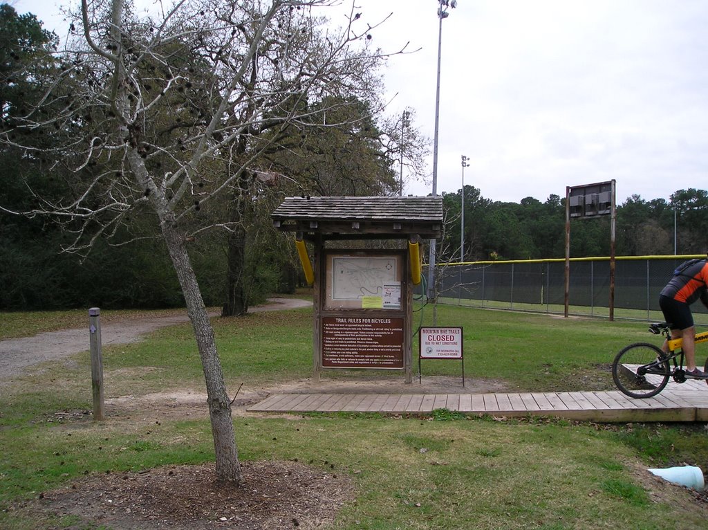
Scoring: Walking = 4.5 Nature = 4
Walking: the park loses points for not having signage that tells you where to walk and how long the trail is, as well as occasionally muddy path sections.
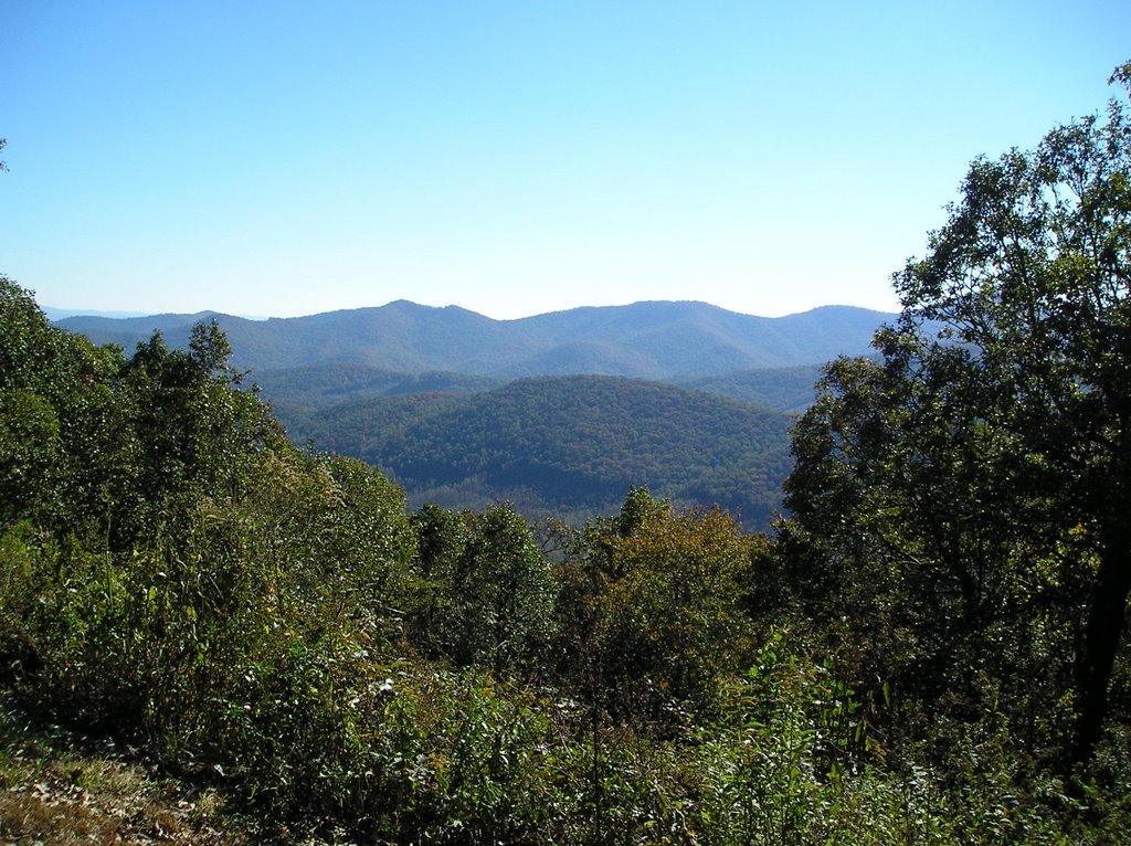
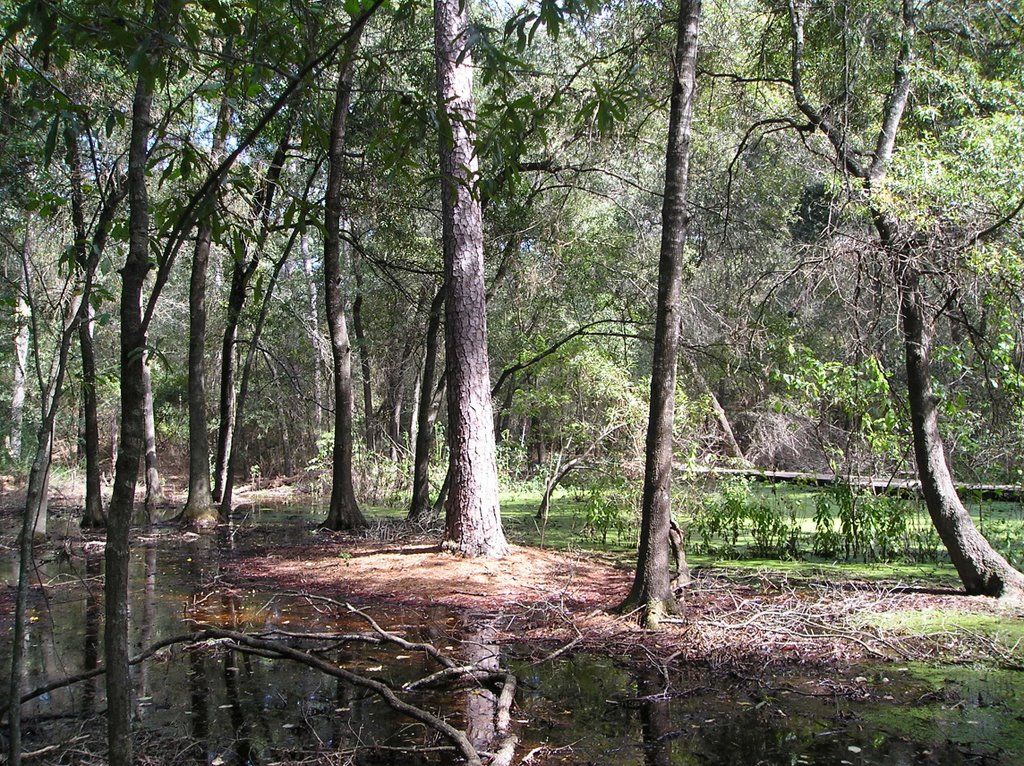
Nature: the park loses points for not having much in the way of natural woods. It's mostly groomed although moderately to heavily wooded.
(graded on scale of 1(bad) to 5(excellent), but based on what is available on Houston. For example, a 5 in Houston (the best) is not = to a 5 nation-wide, think Grand Canyon, Rocky Mountains, etc.)

Background: The park includes, not only the Houston Museum of Natural Science (including IMAX and the Butterfly space), but the Houston Zoo.
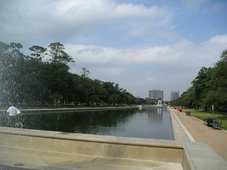
Also in the park are the Molly Gibbs and Jesse H. Jones Reflection Pool,
the Molly Ann Smith and Sara H. and John H. Lindsey Plazas,
and the recently enlarged McGovern Lake which include three new islands as well as bird and wetland habitat area.
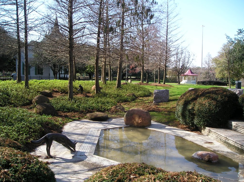
Japanese Gardens
80 additional acres have been added to park along Brays Bayou
Miller Outdoor Theatre
Hermann Park Golf Course
Hermann Park Miniature Train track

What that means for Houstonians and visitors is a beautiful, well-lit park with art, walkways, water features, trees and landscaping and more.

Coolest Thing About Park: Three fountains at reflection pond and occasionally very cool "urban experiences" in this park. Have come across Russian group singing, Tai Chi group practicing, guitar music, an old man fishing with old fashioned gear from China and playing on a Chinese stringed instrument, and, of course, rehearsals at the Miller Outdoor Theater (dance, opera, plays, concerts, etc.)

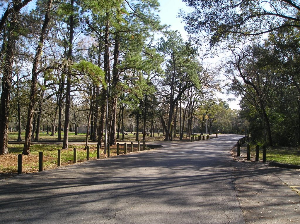
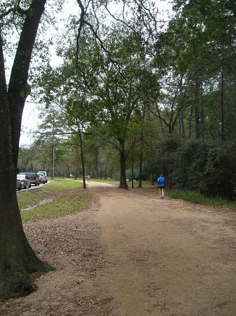
Trails: If you enter Hermann Park through the main entrance near the Mecom Fountain on Main St. you'll see the newly rebuilt reflection pond on your right with parking adjacent to it. There is a one mile (more or less depending on route) walk around the lake, starting at the reflection pond, turn right to go over the bridge, left around by the children's playgrounds, turn left to go by the zoo, and left again to continue along the lake and by Miller Outdoor Theater and back to the reflection pond. You can extend this walk by taking all the curves and by going through the Japanese Garden which is adjacent to the reflection pond. Miller Outdoor Theater has a "hill" that is perfect for getting a boost out of your walk or jog. Try running or walking up and down and around it a few times. If instead you cross the street at the Miller Outdoor theater, you can take a two mile level track around the golf course. Or walk through the rose and herb gardens at the Houston Garden Center. You may also cross Main Street where there is the three mile track around Rice University. So depending on route, you can easily do one, two, three or six miles by combining these. More than half the walks are under large trees and in the shade. Most walkways are asphault, concrete or crushed granite walkways. There is some puddling and mud on the walkways after rain, but easily walked around.

There is also a walk along Brays Bayou which connects to the walk near the rose garden and golf course. I'm not comfortable walking this somewhat isolated trail alone (being a female), but it's a great walk with someone. Not much shade though. It connects with other bayou walks, so you can walk a lot farther.

Other things you'll want to know:

1. Water fountains all around the lake, but none on the two mile trail or the one around Rice University.
2. Shadiest walk is the two miles around golf course.
3. Noisy along side streets for part of two mile trail and all around the Rice University trail.
4. Would not walk any of these after dark.
5. Wildlife includes birds, ducks, geese, turtles, frogs, squirrels, snakes, fish.
6. There are three fountains around the reflection pond which make great places to cool off while walking in summer. Additionally, the children's playgrounds have water sprinklers shaped like trees and tunnels where you can cool off as well. There is a big button on a pole that you push for the water to start.
7. Watch for flying golf balls when going around the golf course track.
8. Restrooms are at Miller Outdoor Theater, children's playground, Japanese Garden, and rose garden. There are no restrooms on the two mile track around the golf course.
9. For safety, take your cell phone and ID. Walkways are fairly even, but cyclists and joggers use same trail, so you'll need to pay attention. Usually enough people are around during daylight hours for you to feel comfortable walking alone. There are usually security people around Miller Outdoor Theater and almost always some park maintenance folks around.
11. Signage in park could be much improved, but you really can't get lost. Maps are available online at http://www.hermannpark.org/directions.html
12. Parking can be a problem when major events are planned in park or on brilliant summer weekend days.

All blog content is copyrighted, all rights reserved, Mary Anne Fields and Life Unfolds, 2006

Feel free to add any comments you think would be useful to others about Hermann Park.